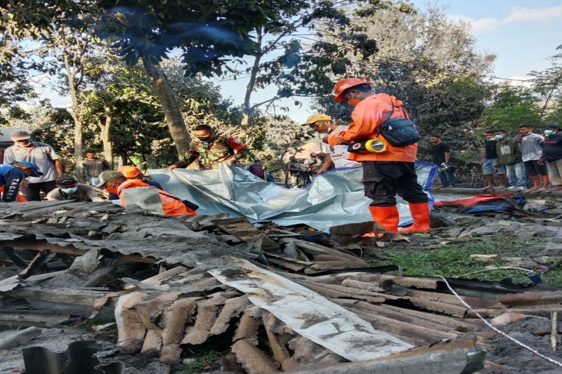
Jakarta (ANTARA) - Officers have begun preparing several refugee camps for at least 10,295 victims affected by the eruption of Mount Lewotobi Laki-laki in East Flores, East Nusa Tenggara, on Monday.
Head of the Operations Control Center at the National Disaster Mitigation Agency (BNPB), Bambang Surya Putra, noted in a statement from his office that a total of 2,735 families, or 10,295 people, were affected by the eruption.
The eruption impacted 207 families, or 816 residents, from the villages of Dulipali, Nobo, Nurabelen, and Rita Rita. Victims from Dulipali Village are currently being evacuated to the refugee camp in the school building in Lewolaga Village.
Moreover, 9,479 residents from the villages of Pululera, Nawakote, Hokeng Jaya, Boru, and Boru Kedang in the Wulanggitang Sub-district bore the brunt of the eruption.
Additionally, residents from the villages of Konga, Kobasoma, Bokang, Wolomatang, and Watowara in Tithena Sub-district were affected.
Meanwhile, residents reported 10 people having died due to the disaster, with eight of them being residents of Wulanggitang Sub-district.
However, no official reports have been received regarding the number of victims and their status or the damage due to the eruption of Mount Lewotobi Laki-laki. The joint officers are still collecting data in the field.
Mount Lewotobi Laki-laki erupted on Monday morning at 2:48 local time. The eruption was recorded on a seismogram with a maximum amplitude of 17 millimeters and a duration of approximately three minutes and five seconds.
The danger zone limit for community activities is seven kilometers from the peak of Mount Lewotobi, whose status has been announced to increase from level III to level IV by the Geological Agency of the Ministry of Energy and Mineral Resources.
The agency reported that volcanic activity on Mount Lewotobi has increased significantly in recent weeks.
An officer from the Observation Post of the Volcano Geological Agency in Pululera Village, Walanggitang Sub-district, detected slow-advancing lava material in the mountain's northeastern part while Sentinel 2 satellite imagery revealed potential lava formations in the northern and eastern areas.
Seismic activity intensified until Saturday (November 2), with 119 deep and shallow volcanic earthquakes, 19 shallow volcanic earthquakes, and six harmonic tremor earthquakes.
Residents dwelling within a seven-kilometer radius of the summit must remain vigilant about possible cold lava flows from the peak of the mountain, particularly during heavy rainfall periods.
Baca juga: The spread of Mt. Lewotobi ash impacts two airports: BMKG
Baca juga: Mount Lewotobi: PVMBG issues warning of cold lava floods
Baca juga: Mt. Lewotobi Laki-Laki volcanic activity continues to decline: PVMBG


